فاس نيوز ميديا جريدة الكترونية جهوية تعنى بشؤون و أخبار جهة فاس مكناس – متجددة على مدار الساعة

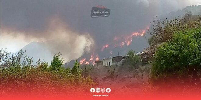
The National Agency for Water and Forests (ANWF) has announced the release of predictive maps aimed at accurately identifying sensitive areas at risk of forest fires in Morocco, based on recent scientific data.
The move comes as part of the agency’s efforts to anticipate the phenomenon of forest fires at the national level and strengthen prevention measures.
According to a statement issued by the agency, these maps will be revised on a daily basis from Monday, July 29, 2024 to Wednesday, July 31, 2024. These forecasts are based on a comprehensive analysis of data related to the quality and flammability of forest cover, as well as climate forecasts and topographical conditions of the regions.
In determining the degree of risk, the agency categorized the areas into three categories:
Extreme risk (red level), which includes the provinces of Chefchaouen, Taza, Cherif, Sefrou, Khenifra, Ifrane, Beni Mellal, Azilal, Jeddah Ankad, and Taroudant.
High risk (orange level), which includes the provinces of Tangier-Asilah, Zan, Taounate, Al Hoceima, Drouiche, and Essaouira.
Medium risk (yellow level), which includes the provinces of Tetouan, Al-Madiq Al-Fnideq, Larache, Fahs Enjara, Rabat, Skhirat Tamara, Salé, Kenitra, Nador, Berkane, and Agadir Edda Autanan.
The agency stressed the importance of exercising caution and caution by residents near forested areas and workers, as well as vacationers and visitors, and called on them to avoid any activity that may cause fires, and to immediately report to the local authorities if any smoke or suspicious behavior is detected.
The measures come as part of the National Water and Forestry Agency’s efforts to tackle forest fires and preserve the country’s environment and biodiversity.
Source : Fez News Media