فاس نيوز ميديا جريدة الكترونية جهوية تعنى بشؤون و أخبار جهة فاس مكناس – متجددة على مدار الساعة

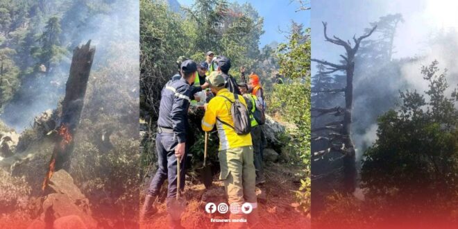
Chefchaouen – The forest of Mount Tiziran, the highest peak in the Chefchaouen region, witnessed a new fire outbreak on Monday morning, with flames spreading rapidly due to strong wind gusts.
According to local sources, civil defense teams and forest guards from the municipalities of Bab Berred, Tamorot, and Iounane, along with workers from the National Agency for Water and Forests (ANEF), rushed to the fire site to combat the blaze. Sources indicated that firefighting efforts face difficulties due to the mountainous terrain of the area, but have succeeded in containing most of the fire hotspots and preventing its spread to the rest of the forest.
While the extinguishing operation is still ongoing, the Royal Gendarmerie has opened an investigation to determine the circumstances and causes of the fire, which remain unknown.
This incident comes just days after the National Agency for Water and Forests warned on Friday, June 21, of a “medium” to “extreme” risk of forest fires in several provinces of the Kingdom during the period from June 22 to 24.
After analyzing data related to forest types, their combustibility, and other climatic factors, the agency identified an extreme risk (red level) in the provinces of Tangier-Asilah, Fahs-Anjra, Nador, Taza, Khenifra, Larache, Taounate, Berkane, Al Haouz, and Essaouira.
The agency also noted that the risk was high (orange level) in the provinces of Tetouan, Mdiq-Fnideq, Chefchaouen, Taroudant, Beni Mellal, Khemisset, Taourirt, and Oujda-Angad, and medium (yellow level) in the provinces of Al Hoceima, Kenitra, Sidi Slimane, and Agadir-Ida-Outanane.
ANEF called on residents of areas adjacent to forests, all vacationing citizens and visitors, as well as those working in forest environments, to exercise vigilance and take necessary precautions to prevent forest fires. It also encouraged prompt reporting to local authorities in case of observed smoke or suspicious behavior.
To anticipate the problem of forest fires in the country, the National Agency for Water and Forests produces daily precise maps using scientific prediction models, helping to identify areas at risk throughout the national territory.